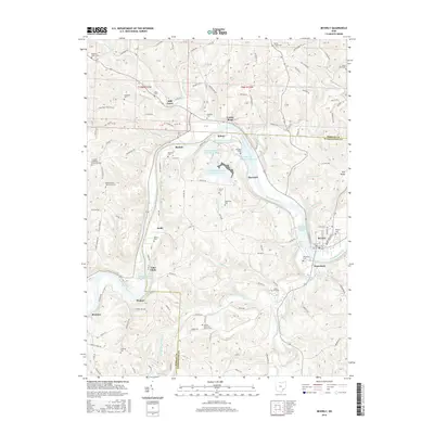
2016 Map of Beverly
USGS Topo · Published 2016About this map
The Muskingum River dominates this corner of Ohio, winding past the historic river towns of Waterford and Beverly. The presence of Muskingum River Lock and Dam Number 2 and Muskingum River Lock and Dam Number 3 highlights the enduring importance of this waterway for navigation and regional infrastructure. To the north and west, the landscape is dotted with smaller settlements like Mill Grove, Relief, and Beckett, while the southern reaches feature the curiously named Luke Chute. This 2016 survey also documents modern industrial features such as the Muskingum River Fly Ash Reservoir and various ash impoundments, illustrating the intersection of old river commerce with contemporary energy production. Genealogists will find a high density of rural burial grounds, including Center Memorial Church Cem, Smiths Chapel Cem, and Meigsville Cem, which anchor the surrounding farmsteads and ridges.
Find a feature on this map
158 named features on this map. Tap any name to fly to it.
Don’t see what you’re looking for? This feature index may not catch every label — zoom into the map to look around manually.
Map Details
Editions of this 2016 Beverly Map
This is the sole edition of this map. No revisions or reprints were ever made.
Other maps of this area

1902 · Parkersburg
USGS Topo · 1:62,500

1904 · Parkersburg
USGS Topo · 1:62,500

1904 · Chesterhill
USGS Topo · 1:62,500

1906 · Chesterhill
USGS Topo · 1:62,500

1909 · Caldwell
USGS Topo · 1:62,500

1910 · Mc Connelsville
USGS Topo · 1:62,500

1912 · Caldwell
USGS Topo · 1:62,500

1949 · Clarksburg
USGS Topo · 1:250,000

1956 · Clarksburg
USGS Topo · 1:250,000

1960 · Watertown
USGS Topo · 1:24,000