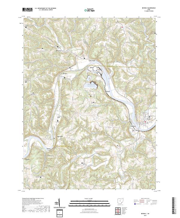
2023 Map of Beverly
USGS Topo · Published 2023About this map
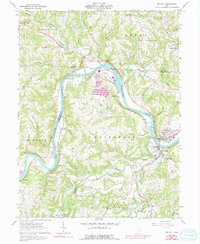
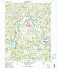
The Muskingum River dominates this landscape as it meanders through the boundary of Morgan and Washington counties, anchoring a series of riverfront settlements including Waterford, Beverly, and Luke Chute. This modern survey illustrates the industrial legacy of the region, notably through the Muskingum River Fly Ash Reservoir and the AEP Belt Line, which reflect the area's energy production history. Genealogists will find a high density of rural burial grounds, such as Smiths Chapel Cem and Center Memorial Church Cem, scattered across the dissected terrain of Tick Ridge. The map captures a transition from the compact street grids of the riverside towns to the dispersed hamlets of Mill Grove and Relief, connected by a network of township roads that follow the winding paths of Wolf Creek and Olive Green Creek.
Find a feature on this map
129 named features on this map. Tap any name to fly to it.
Don’t see what you’re looking for? This feature index may not catch every label — zoom into the map to look around manually.
Map Details
Editions of this 2023 Beverly Map
This is the sole edition of this map. No revisions or reprints were ever made.
Historical Maps of Relief Through Time
3 maps found