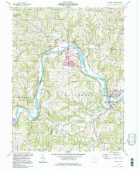
1994 Map of Beverly
USGS Topo · Published 1998About this map
The Muskingum River dominates this landscape, winding through the boundary of Morgan and Washington counties as a central artery for the surrounding settlements. Along its banks and the adjacent ridges, established communities like Beverly and Waterford anchor the southeastern corner, while smaller hamlets and rural landmarks such as Moscow Mills, Swift, and Luke Chute indicate the area's agricultural and river-based development. The map reveals a dense network of family and community history, evidenced by numerous burial grounds including Meigsville Cem, DeLong Cem, and Milnor Cem.
Find a feature on this map
68 named features on this map. Tap any name to fly to it.
Don’t see what you’re looking for? This feature index may not catch every label — zoom into the map to look around manually.
Map Details
Editions of this 1994 Beverly Map
This is the sole edition of this map. No revisions or reprints were ever made.
Other maps of this area

1902 · Parkersburg
USGS Topo · 1:62,500

1904 · Parkersburg
USGS Topo · 1:62,500

1904 · Chesterhill
USGS Topo · 1:62,500

1906 · Chesterhill
USGS Topo · 1:62,500

1909 · Caldwell
USGS Topo · 1:62,500

1910 · Mc Connelsville
USGS Topo · 1:62,500

1912 · Caldwell
USGS Topo · 1:62,500

1949 · Clarksburg
USGS Topo · 1:250,000

1956 · Clarksburg
USGS Topo · 1:250,000

1960 · Watertown
USGS Topo · 1:24,000