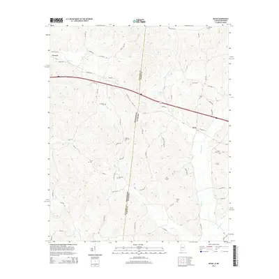
2014 Map of Bexar
USGS Topo · Published 2014About this map
Mississippi Alabama borderlands define this 2014 survey, where the state line bisects a landscape of headwater creeks and rural homesteads. The small community of Tremont occupies the northwestern corner in Itawamba County, while Bexar sits to the east across the Marion County line. This area is heavily marked by family and community history, evidenced by the high density of small cemeteries such as Wigginton Cem, Concord Cem, and Stevens Cem scattered among the timbered hills. The drainage pattern is complex, with Johns Cr and Dry Cr feeding larger systems, while the southern reaches are defined by Sipsey Cr and Barnesville Cr. Local transportation relies on a network of named county roads like Mauldin Rd and Guthrie Cut Rd, which weave around the ridgelines and creek bottoms that have shaped settlement here for generations.
Find a feature on this map
71 named features on this map. Tap any name to fly to it.
Don’t see what you’re looking for? This feature index may not catch every label — zoom into the map to look around manually.
Map Details
Editions of this 2014 Bexar Map
This is the sole edition of this map. No revisions or reprints were ever made.
Other maps of this area

1936 · Vina
USGS Topo · 1:24,000

1950 · Vina
USGS Topo · 1:24,000

1951 · Vina
USGS Topo · 1:24,000

1956 · Tupelo
USGS Topo · 1:250,000

1958 · Tupelo
USGS Topo · 1:250,000

1965 · Fulton SE
USGS Topo · 1:24,000

1966 · Turon
USGS Topo · 1:24,000

1966 · Tremont
USGS Topo · 1:24,000
1967 · Weston
USGS Topo · 1:24,000
1967 · Henson Springs
USGS Topo · 1:24,000