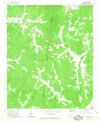
1967 Map of Bexar
USGS Topo · Published 1968About this map
Mississippi and Alabama borderlands meet in this late 1960s survey, detailing a landscape defined by small rural settlements and agricultural clearings. The community of Bexar serves as a central point in Marion County, surrounded by a network of family-named landmarks and local institutions. The presence of numerous cemeteries and country churches, such as Elvis Spearman Ch and Guthrie Cut Ch, suggests a deeply rooted community structure maintained through generations.
Find a feature on this map
29 named features on this map. Tap any name to fly to it.
Don’t see what you’re looking for? This feature index may not catch every label — zoom into the map to look around manually.
Map Details
Editions of this 1967 Bexar Map
This is the sole edition of this map. No revisions or reprints were ever made.
Other maps of this area

1936 · Vina
USGS Topo · 1:24,000

1950 · Vina
USGS Topo · 1:24,000

1951 · Vina
USGS Topo · 1:24,000

1956 · Tupelo
USGS Topo · 1:250,000

1958 · Tupelo
USGS Topo · 1:250,000

1965 · Fulton SE
USGS Topo · 1:24,000

1966 · Turon
USGS Topo · 1:24,000

1966 · Tremont
USGS Topo · 1:24,000
1967 · Weston
USGS Topo · 1:24,000
1967 · Henson Springs
USGS Topo · 1:24,000