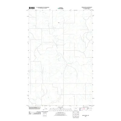
2011 Map of Biem School
USGS Topo · Published 2011About this map
Biem characterizes the sparse settlement pattern of Roosevelt County's northern plains in the early 21st century. The landscape is defined by the winding course of Smoke Creek, which drains a complex network of coulees and small tributaries across the high prairie. Transportation in this corner of the state relies on the north-south corridor of Brockton Rd, providing the primary link through the open terrain. This survey reflects the enduring character of the Montana ranching country, where large-scale land divisions and intermittent water sources dictate the placement of rural homesteads and infrastructure.
Find a feature on this map
3 named features on this map. Tap any name to fly to it.
Don’t see what you’re looking for? This feature index may not catch every label — zoom into the map to look around manually.
Map Details
Editions of this 2011 Biem School Map
This is the sole edition of this map. No revisions or reprints were ever made.
Other maps of this area

1909 · Smoke Creek
USGS Topo · 1:62,500

1912 · Hay Creek
USGS Topo · 1:62,500

1912 · Smoke Creek
USGS Topo · 1:62,500

1950 · Coyote Coulee
USGS Topo · 1:24,000

1954 · Wolf Point
USGS Topo · 1:250,000

1958 · Wolf Point
USGS Topo · 1:250,000

1973 · Pleasant Prairie
USGS Topo · 1:24,000

1982 · Culbertson
USGS Topo · 1:100,000
1983 · Smoke Creek SW
USGS Topo · 1:24,000
1983 · Geddart Lake
USGS Topo · 1:24,000