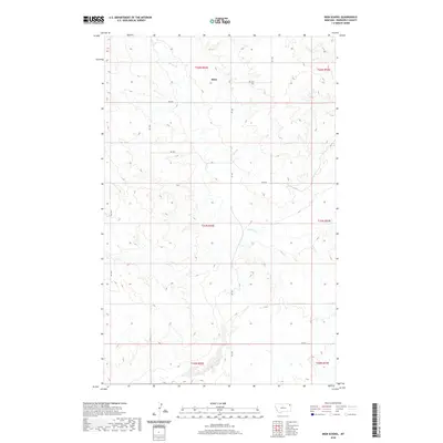
2020 Map of Biem School
USGS Topo · Published 2020About this map
Biem serves as the primary focal point of this rural Roosevelt County landscape, situated amidst a network of section-line roads and drainage patterns in northeastern Montana. The terrain is defined by the winding course of Smoke Cr, which meanders through the central and southern portions of the sheet, providing a natural contrast to the rigid geometry of the Public Land Survey System. A grid of local routes, including Rd 1041 and Rd 2037, provides access across the township lines of t31n r52e and t32n r52e. This survey captures the region in the early 21st century, illustrating a sparsely populated agricultural or grazing environment where the infrastructure is largely limited to essential transit corridors like Rd 1044 and Rd 1040.
Find a feature on this map
17 named features on this map. Tap any name to fly to it.
Don’t see what you’re looking for? This feature index may not catch every label — zoom into the map to look around manually.
Map Details
Editions of this 2020 Biem School Map
This is the sole edition of this map. No revisions or reprints were ever made.
Other maps of this area

1909 · Smoke Creek
USGS Topo · 1:62,500

1912 · Hay Creek
USGS Topo · 1:62,500

1912 · Smoke Creek
USGS Topo · 1:62,500

1950 · Coyote Coulee
USGS Topo · 1:24,000

1954 · Wolf Point
USGS Topo · 1:250,000

1958 · Wolf Point
USGS Topo · 1:250,000

1973 · Pleasant Prairie
USGS Topo · 1:24,000

1982 · Culbertson
USGS Topo · 1:100,000
1983 · Smoke Creek SW
USGS Topo · 1:24,000
1983 · Geddart Lake
USGS Topo · 1:24,000