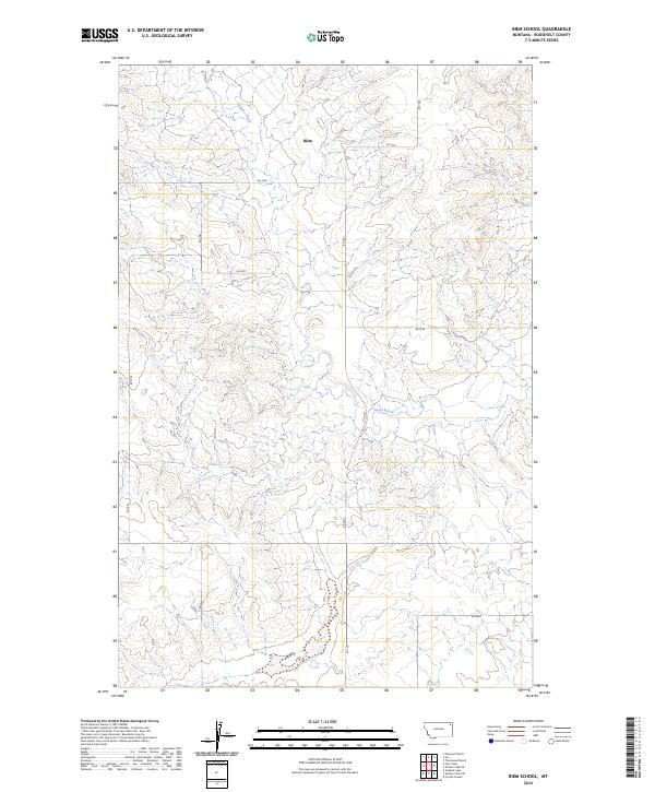
2024 Map of Biem School
USGS Topo · Published 2024About this map
Biem serves as the primary named point in this northeastern Montana landscape, situated within the Public Land Survey System grids of t32n r52e and t31n r52e. The drainage of Smoke Creek meanders through the central and northern sections of the terrain, carving a path through the high plains. This modern survey illustrates a network of rural access routes, including RD 1043 and RD 1041, which define the movement across Roosevelt County. The map provides a clear look at the township and range divisions that have organized this territory since the era of homesteading, showing how few named settlements remain in this expansive grazing and agricultural region. For researchers, the map clarifies the precise location of the Biem site relative to the seasonal watercourse of Smoke Creek and the surrounding section lines.
Find a feature on this map
16 named features on this map. Tap any name to fly to it.
Don’t see what you’re looking for? This feature index may not catch every label — zoom into the map to look around manually.
Map Details
Editions of this 2024 Biem School Map
This is the sole edition of this map. No revisions or reprints were ever made.
Other maps of this area

1909 · Smoke Creek
USGS Topo · 1:62,500

1912 · Hay Creek
USGS Topo · 1:62,500

1912 · Smoke Creek
USGS Topo · 1:62,500

1950 · Coyote Coulee
USGS Topo · 1:24,000

1954 · Wolf Point
USGS Topo · 1:250,000

1958 · Wolf Point
USGS Topo · 1:250,000

1973 · Pleasant Prairie
USGS Topo · 1:24,000

1982 · Culbertson
USGS Topo · 1:100,000
1983 · Smoke Creek SW
USGS Topo · 1:24,000
1983 · Geddart Lake
USGS Topo · 1:24,000