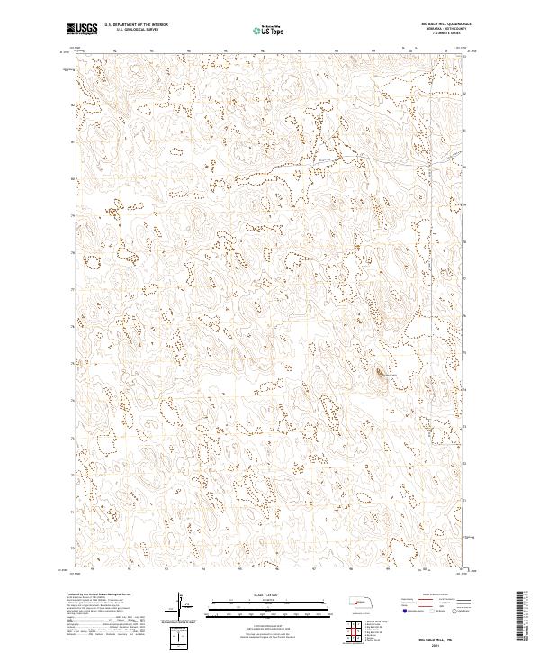
2021 Map of Big Bald Hill
USGS Topo · Published 2021About this map
Big Bald Hill rises above the rolling terrain of northern Keith County, defining a landscape marked by its vast, undulating topography and intermittent wetlands. This section of the Nebraska Sandhills is sparsely populated, with the modern infrastructure primarily consisting of a rectilinear grid of section lines and gravel paths such as Rd East 250 and Rd East T N. The map details the Township and Range system, specifically covering parts of t16n r36w, t16n r35w, t15n r36w, and t15n r35w. The lack of named settlements reflects the region's enduring character as open rangeland, where land management and ranching operations are organized around these surveyed boundaries rather than concentrated town sites.
Find a feature on this map
7 named features on this map. Tap any name to fly to it.
Don’t see what you’re looking for? This feature index may not catch every label — zoom into the map to look around manually.
Map Details
Editions of this 2021 Big Bald Hill Map
This is the sole edition of this map. No revisions or reprints were ever made.
Other maps of this area

1897 · Ogallala
USGS Topo · 1:125,000

1898 · Paxton
USGS Topo · 1:125,000

1900 · Ogallala
USGS Topo · 1:125,000

1901 · Paxton
USGS Topo · 1:125,000

1954 · North Platte
USGS Topo · 1:250,000

1956 · North Platte
USGS Topo · 1:250,000

1957 · North Platte
USGS Topo · 1:250,000

1967 · North Platte
USGS Topo · 1:250,000
1971 · Spotted Horse Valley
USGS Topo · 1:24,000
1971 · Glinn Ranch
USGS Topo · 1:24,000