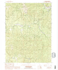
1982 Map of Big Bar
USGS Topo · Published 1982About this map
Big Bar and the adjacent Trailer Park serve as the primary human settlements along the Trinity River in this 1982 survey of the Trinity National Forest. The map documents a landscape defined by deep drainages and high peaks, with Pattison Peak and Monument Peak towering over numerous named watercourses like Hayshed Creek and Miners Creek. A small Cem near the river bank provides a localized point of interest for genealogical research.
Find a feature on this map
31 named features on this map. Tap any name to fly to it.
Don’t see what you’re looking for? This feature index may not catch every label — zoom into the map to look around manually.
Map Details
Editions of this 1982 Big Bar Map
2 editions found
Other maps of this area

1909 · Big Bar
USGS Topo · 1:96,000

1915 · Big Bar and Vicinity
USGS Topo · 1:250,000

1951 · Hayfork
USGS Topo · 1:62,500

1951 · Helena
USGS Topo · 1:62,500

1951 · Hyampom
USGS Topo · 1:62,500

1951 · Ironside Mountain
USGS Topo · 1:62,500

1958 · Redding
USGS Topo · 1:250,000

1982 · Helena
USGS Topo · 1:24,000
1982 · Big Bar
USGS Topo · 1:24,000
1982 · Hayfork Bally
USGS Topo · 1:24,000