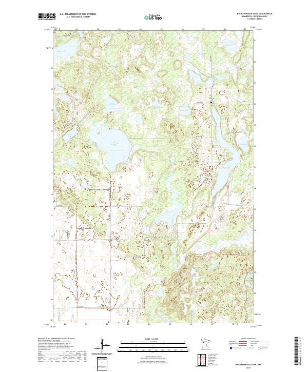
2022 Map of Big Basswood Lake
USGS Topo · Published 2022About this map
Big Basswood Lake and the surrounding wetland complex define this portion of Becker County, where glacial depressions have created a dense network of lakes and marshes. The landscape is interconnected by waterways such as Indian Creek and the Straight River, which flows across the southern portion of the sheet. Human presence is marked by a grid of county roads and specialized pathways like the Forest Riders Trails Trl and the Little Scenic Trl, suggesting a region dedicated to outdoor recreation and timber management. Local history is anchored at the Lakeside Cemetery near Coon Lake, situated along Co Rd 46. The map details many smaller named bodies of water, including Mallard Lake, Sockeye Lake, and Abners Lake, each illustrating the characteristic lake-strewn geography of the Minnesota lake country.
Find a feature on this map
37 named features on this map. Tap any name to fly to it.
Don’t see what you’re looking for? This feature index may not catch every label — zoom into the map to look around manually.
Map Details
Editions of this 2022 Big Basswood Lake Map
This is the sole edition of this map. No revisions or reprints were ever made.
Other maps of this area

1953 · Brainerd
USGS Topo · 1:250,000

1954 · Bemidji
USGS Topo · 1:250,000

1957 · Brainerd
USGS Topo · 1:250,000

1957 · Bemidji
USGS Topo · 1:250,000

1958 · Bemidji
USGS Topo · 1:250,000

1958 · Brainerd
USGS Topo · 1:250,000

1965 · Brainerd
USGS Topo · 1:250,000

1969 · Anchor Hill
USGS Topo · 1:24,000

1969 · Big Basswood Lake
USGS Topo · 1:24,000
1969 · Ponsford
USGS Topo · 1:24,000