
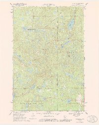
1969 Map of Anchor Hill
USGS Topo · Published 1971About this map
White Earth Indian Reservation Boundary cuts through this landscape of glacial lakes and dense forests at the end of the 1960s. The topography is defined by significant conservation and natural areas, including portions of Itasca State Park, White Earth State Forest, and the Clearwater State Wildlife Management Area. Rising above the surrounding terrain, the Anchor Hill Lookout Tower sits atop Anchor Hill, serving as a primary observation point for forest management.
Find a feature on this map
28 named features on this map. Tap any name to fly to it.
Don’t see what you’re looking for? This feature index may not catch every label — zoom into the map to look around manually.
Map Details
Editions of this 1969 Anchor Hill Map
2 editions found
Other maps of this area

1954 · Bemidji
USGS Topo · 1:250,000

1957 · Bemidji
USGS Topo · 1:250,000

1958 · Bemidji
USGS Topo · 1:250,000

1969 · Big Basswood Lake
USGS Topo · 1:24,000
1969 · Big Rush Lake
USGS Topo · 1:24,000

1969 · Long Lost Lake
USGS Topo · 1:24,000
1969 · Zerkel
USGS Topo · 1:24,000

1969 · Heart Lake
USGS Topo · 1:24,000

1972 · La Salle Lake
USGS Topo · 1:24,000
1972 · Two Inlets
USGS Topo · 1:24,000