
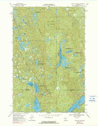
1969 Map of Long Lost Lake
USGS Topo · Published 1971About this map
White Earth State Forest blankets this glacial landscape in the late 1960s, defined by a dense concentration of lakes and wetlands across the border of Clearwater and Becker Counties. This area, situated entirely within the White Earth Indian Reservation, shows a rugged topography where water bodies like the elongated Long Lost Lake and the branching Juggler Lake dominate the geography. The presence of numerous Clearwater State Wildlife Management Areas indicates a landscape preserved for conservation and natural resource management rather than agricultural or urban development.
Find a feature on this map
28 named features on this map. Tap any name to fly to it.
Don’t see what you’re looking for? This feature index may not catch every label — zoom into the map to look around manually.
Map Details
Editions of this 1969 Long Lost Lake Map
2 editions found
Other maps of this area

1954 · Bemidji
USGS Topo · 1:250,000

1957 · Bemidji
USGS Topo · 1:250,000

1958 · Bemidji
USGS Topo · 1:250,000

1969 · Many Point Lake
USGS Topo · 1:24,000

1969 · Roy Lake
USGS Topo · 1:24,000

1969 · Tulaby Lake
USGS Topo · 1:24,000

1969 · Anchor Hill
USGS Topo · 1:24,000

1969 · Big Basswood Lake
USGS Topo · 1:24,000
1969 · Big Rush Lake
USGS Topo · 1:24,000
1969 · Zerkel
USGS Topo · 1:24,000