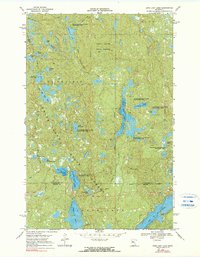
1969 Map of Long Lost Lake
USGS Topo · Published 1990About this map
White Earth State Forest blankets this northern Minnesota landscape, where a dense network of glacial lakes and wetlands defines the local geography. The area, entirely contained within the White Earth Indian Reservation, features a complex aquatic system including Long Lost Lake, Juggler Lake, and Pickerel Lake. To the west, the high ground of La Prairie and the prominence of Anchor Hill break the low-lying terrain. The map documents the extensive Clearwater State Wildlife Management Area, showing how conservation boundaries intersect with the Clearwater and Becker County line. While largely devoid of major settlements, the landscape is dotted with family-named water bodies such as Chloupek Lake, Frellsen Lake, and Stassen Lake, indicating a history of local land use and seasonal habitation focused on the region's natural resources.
Find a feature on this map
25 named features on this map. Tap any name to fly to it.
Don’t see what you’re looking for? This feature index may not catch every label — zoom into the map to look around manually.
Map Details
Editions of this 1969 Long Lost Lake Map
2 editions found
Other maps of this area

1954 · Bemidji
USGS Topo · 1:250,000

1957 · Bemidji
USGS Topo · 1:250,000

1958 · Bemidji
USGS Topo · 1:250,000

1969 · Many Point Lake
USGS Topo · 1:24,000

1969 · Roy Lake
USGS Topo · 1:24,000

1969 · Tulaby Lake
USGS Topo · 1:24,000

1969 · Anchor Hill
USGS Topo · 1:24,000

1969 · Big Basswood Lake
USGS Topo · 1:24,000
1969 · Big Rush Lake
USGS Topo · 1:24,000

1969 · Long Lost Lake
USGS Topo · 1:24,000