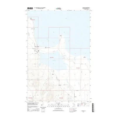
2014 Map of Big Bay
USGS Topo · Published 2014About this map
Lake Independence and the coastal settlement of Big Bay define this landscape along the south shore of Lake Superior. The area's mid-20th-century development is tied closely to the water, with the community of Big Bay serving as a focal point near the Big Bay Cem and Burns Landing. The rugged shoreline is marked by prominent natural features such as Big Bay Point and Black Rock Cape, while Squaw Beach stretches across the northern bay. Further inland, the terrain is shaped by the Yellow Dog River and the cascade at Alder Falls. Small clusters of homes or camps at Homeier, Alder, and Antlers suggest a pattern of seasonal or rural life centered around the region's abundant water bodies, including Brandts Pond and McKenzie Bay.
Find a feature on this map
48 named features on this map. Tap any name to fly to it.
Don’t see what you’re looking for? This feature index may not catch every label — zoom into the map to look around manually.
Map Details
Editions of this 2014 Big Bay Map
This is the sole edition of this map. No revisions or reprints were ever made.
Other maps of this area

1954 · Negaunee
USGS Topo · 1:62,500

1954 · Huron Mountain
USGS Topo · 1:62,500

1954 · Big Bay
USGS Topo · 1:62,500

1955 · Champion
USGS Topo · 1:62,500

1958 · Marquette
USGS Topo · 1:250,000

1960 · Marquette
USGS Topo · 1:250,000

1961 · Marquette
USGS Topo · 1:250,000

1968 · Marquette
USGS Topo · 1:250,000
1984 · Ives Hill
USGS Topo · 1:24,000
1985 · Huron Mountain
USGS Topo · 1:24,000