
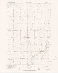
1958 Map of Big Bend City
USGS Topo · Published 1959About this map
The Chippewa River meanders through the southern portion of this landscape, marking the boundary between Swift and Chippewa Counties during the late 1950s. The settlement of Big Bend City anchors the southeast, while the smaller community of Hagan sits just to the west along the riverbank. This area is characterized by a high density of rural educational structures, with several local landmarks such as School No 2287, School No 2249, and School No 297 distributed across the township grids of West Bank and Edison.
Find a feature on this map
20 named features on this map. Tap any name to fly to it.
Don’t see what you’re looking for? This feature index may not catch every label — zoom into the map to look around manually.
Map Details
Editions of this 1958 Big Bend City Map
2 editions found
Other maps of this area

1953 · Saint Cloud
USGS Topo · 1:250,000

1957 · Saint Cloud
USGS Topo · 1:250,000

1958 · Saint Cloud
USGS Topo · 1:250,000

1958 · Milan
USGS Topo · 1:24,000

1958 · Watson
USGS Topo · 1:24,000

1958 · Milan NW
USGS Topo · 1:24,000

1958 · Gracelock NW
USGS Topo · 1:24,000

1958 · Gracelock SW
USGS Topo · 1:24,000

1968 · Danvers
USGS Topo · 1:24,000
1968 · Hancock SW
USGS Topo · 1:24,000