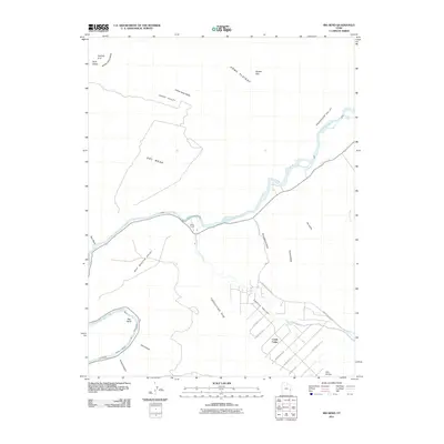
2011 Map of Big Bend
USGS Topo · Published 2011About this map
The Colorado River winds through a landscape of dramatic sandstone formations and high plateaus in this Grand County survey. The settlement of Castle Valley occupies the southeastern corner, where residential lanes like W Powell Ln and W Buchanan Ln branch off from Mountain Loop Rd near the banks of Castle Creek. To the north, the terrain rises sharply toward Porcupine Rim and the Dome Plateau, where the isolated White Ranch sits near a prominent river crossing.
Find a feature on this map
35 named features on this map. Tap any name to fly to it.
Don’t see what you’re looking for? This feature index may not catch every label — zoom into the map to look around manually.
Map Details
Editions of this 2011 Big Bend Map
This is the sole edition of this map. No revisions or reprints were ever made.
Other maps of this area

1885 · La Sal
USGS Topo · 1:250,000

1954 · Mt. Waas 3 NE
USGS Topo · 1:24,000

1954 · Mt. Waas 3 SE
USGS Topo · 1:24,000

1954 · Mt. Waas 3 NW
USGS Topo · 1:24,000

1954 · Mt. Waas 3 SW
USGS Topo · 1:24,000

1954 · Castle Valley
USGS Topo · 1:62,500

1955 · Mt. Waas 2 SE
USGS Topo · 1:24,000

1956 · Moab
USGS Topo · 1:250,000

1958 · Thompson
USGS Topo · 1:62,500

1958 · Cisco
USGS Topo · 1:62,500