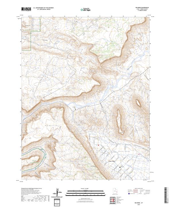
2023 Map of Big Bend
USGS Topo · Published 2023About this map
Arches National Park defines the northwestern reaches of this Grand County landscape, where the famous Delicate Arch stands as a primary landmark above Winter Camp Wash. The Colorado River carves a deep path through the center of the sheet, creating prominent features like the Big Bend and navigating through Rocky Rapids and White Rapids. South of the river, the residential layout of Castle Valley emerges, oriented along roads like Castle Valley Dr and Mountain Loop Rd. This area is characterized by a mix of high-desert terrain and river-bottom geography, including the dramatic elevations of Parriott Mesa and Porcupine Rim. Local history is anchored at the Castle Valley Cem and Red Cliffs Cem, while the drainage systems of Professor Valley and Cache Valley illustrate the complex erosion patterns of the Colorado Plateau.
Find a feature on this map
53 named features on this map. Tap any name to fly to it.
Don’t see what you’re looking for? This feature index may not catch every label — zoom into the map to look around manually.
Map Details
Editions of this 2023 Big Bend Map
This is the sole edition of this map. No revisions or reprints were ever made.
Other maps of this area

1885 · La Sal
USGS Topo · 1:250,000

1954 · Mt. Waas 3 NE
USGS Topo · 1:24,000

1954 · Mt. Waas 3 SE
USGS Topo · 1:24,000

1954 · Mt. Waas 3 NW
USGS Topo · 1:24,000

1954 · Mt. Waas 3 SW
USGS Topo · 1:24,000

1954 · Castle Valley
USGS Topo · 1:62,500

1955 · Mt. Waas 2 SE
USGS Topo · 1:24,000

1956 · Moab
USGS Topo · 1:250,000

1958 · Thompson
USGS Topo · 1:62,500

1958 · Cisco
USGS Topo · 1:62,500