
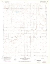
1959 Map of Big Bow NW
USGS Topo · Published 1960About this map
The high plains of western Kansas in the late 1950s are defined by an emerging energy economy and sparse agricultural landscape. Bear Creek and Little Bear Creek carve winding paths across the terrain, providing the primary relief in an otherwise expansive upland area. The map documents the early proliferation of the Hugoton Gas Area, with numerous Gas Wells and individual Wells dotting the landscape, signaling the shift toward industrial extraction in Stanton County. Settled history is anchored by the Mitchell Cem near the western border, while the northern sections include the high ground of Lamont. Transportation is limited to a grid of light-duty and unimproved roads that navigate between the section lines and the sandy draws of the creek beds, including a local Gravel Pit near the center of the survey area.
Find a feature on this map
10 named features on this map. Tap any name to fly to it.
Don’t see what you’re looking for? This feature index may not catch every label — zoom into the map to look around manually.
Map Details
Editions of this 1959 Big Bow NW Map
2 editions found
Other maps of this area

1900 · Syracuse
USGS Topo · 1:125,000

1920 · Syracuse
USGS Topo · 1:125,000

1955 · Dodge City
USGS Topo · 1:250,000

1958 · Dodge City
USGS Topo · 1:250,000

1959 · Dodge City
USGS Topo · 1:250,000

1959 · Big Bow NE
USGS Topo · 1:24,000

1959 · Big Bow SW
USGS Topo · 1:24,000
1959 · Big Bow
USGS Topo · 1:24,000

1966 · Syracuse East SW
USGS Topo · 1:24,000
1966 · Syracuse West SE
USGS Topo · 1:24,000