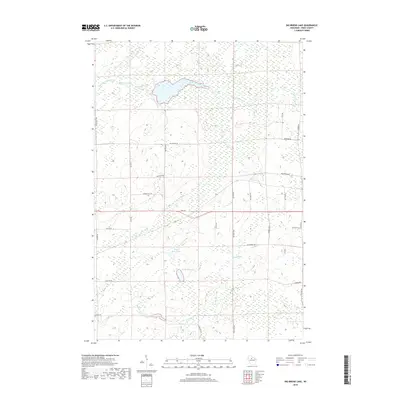
2018 Map of Big Briens Lake
USGS Topo · Published 2018About this map
South Fork Jump River meanders across the northern reaches of this landscape, anchoring a wilderness area defined by its complex hydrology and glacial depression lakes. Central to this Price County terrain are the neighboring basins of Big Briens Lake and Little Briens Lake, which provide a focal point for the surrounding network of drainage creeks like Douglas Cr and Knox Cr. The road network reflects a history of rural access and timber management, with interestingly named corridors such as Mail Route Rd and Nyberg-Hill Rd traversing the interior. This survey captures a moment in the 21st century where the land remains primarily characterized by its wetlands and small kettle lakes, including the isolated Moyle Lake to the northwest. The presence of numerous family-named roads, from Hannula Rd to Lustila Rd, hints at the deep-rooted homesteading and landownership patterns of this specific Wisconsin northwoods region.
Find a feature on this map
32 named features on this map. Tap any name to fly to it.
Don’t see what you’re looking for? This feature index may not catch every label — zoom into the map to look around manually.
Map Details
Editions of this 2018 Big Briens Lake Map
This is the sole edition of this map. No revisions or reprints were ever made.
Other maps of this area

1941 · Phillips
USGS Topo · 1:48,000

1941 · Brantwood
USGS Topo · 1:48,000

1943 · Philliips
USGS Topo · 1:48,000

1943 · Brantwood
USGS Topo · 1:48,000

1944 · Ogema
USGS Topo · 1:48,000

1945 · Rib Lake
USGS Topo · 1:48,000

1947 · Rib Lake
USGS Topo · 1:48,000

1947 · Ogema
USGS Topo · 1:48,000

1949 · Ogema
USGS Topo · 1:48,000

1949 · Rib Lake
USGS Topo · 1:48,000