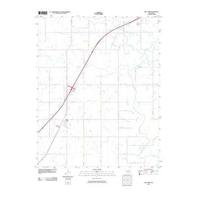
2010 Map of Big Cabin
USGS Topo · Published 2010About this map
Big Cabin serves as a focal point for this Craig County landscape, situated at a major transportation junction marked by the Big Cabin Interchange. The terrain is defined by a dense network of sectional roads and the winding paths of Big Cabin Creek and White Oak Creek. These watercourses carve through a primarily rural expanse that includes smaller named locales like Hulwe and Longview.
Find a feature on this map
30 named features on this map. Tap any name to fly to it.
Don’t see what you’re looking for? This feature index may not catch every label — zoom into the map to look around manually.
Map Details
Editions of this 2010 Big Cabin Map
This is the sole edition of this map. No revisions or reprints were ever made.
Other maps of this area

1896 · Pryor
USGS Topo · 1:125,000

1901 · Vinita
USGS Topo · 1:125,000

1901 · Pryor
USGS Topo · 1:125,000

1913 · Vinita
USGS Topo · 1:125,000

1954 · Tulsa
USGS Topo · 1:250,000

1958 · Tulsa
USGS Topo · 1:250,000

1963 · Tulsa
USGS Topo · 1:250,000

1969 · Adair
USGS Topo · 1:24,000

1970 · White Oak
USGS Topo · 1:24,000
1971 · Strang
USGS Topo · 1:24,000