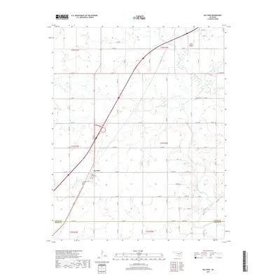
2019 Map of Big Cabin
USGS Topo · Published 2019About this map
Big Cabin sits at the intersection of major transit corridors in Craig County, serving as a focal point for this rural landscape. The settlement is defined by its proximity to the Vinita Municipal Airport and a network of county roads that section the terrain into traditional agricultural blocks. Waterways including Big Cabin Creek, Little Cabin Creek, and White Oak Cr weave through the region, providing a natural structure to the topography between the smaller communities of Longview and the town proper. Local genealogy and history are preserved at the Big Cabin Cem and Landrum Cem, which anchor the map's western and eastern reaches respectively. The map illustrates a contemporary view of the region's connectivity, showing how modern infrastructure follows the same creek valleys and ridges that have historically defined northern Oklahoma settlement patterns.
Find a feature on this map
57 named features on this map. Tap any name to fly to it.
Don’t see what you’re looking for? This feature index may not catch every label — zoom into the map to look around manually.
Map Details
Editions of this 2019 Big Cabin Map
This is the sole edition of this map. No revisions or reprints were ever made.
Other maps of this area

1896 · Pryor
USGS Topo · 1:125,000

1901 · Vinita
USGS Topo · 1:125,000

1901 · Pryor
USGS Topo · 1:125,000

1913 · Vinita
USGS Topo · 1:125,000

1954 · Tulsa
USGS Topo · 1:250,000

1958 · Tulsa
USGS Topo · 1:250,000

1963 · Tulsa
USGS Topo · 1:250,000

1969 · Adair
USGS Topo · 1:24,000

1970 · White Oak
USGS Topo · 1:24,000
1971 · Strang
USGS Topo · 1:24,000