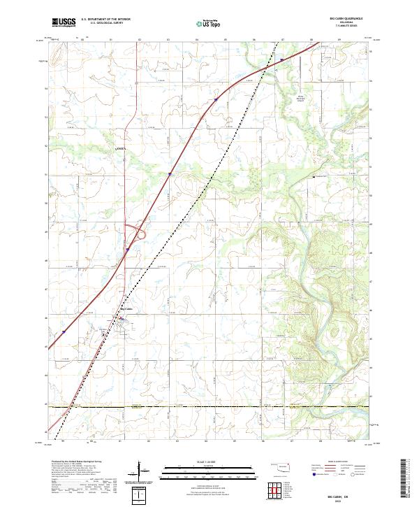
2022 Map of Big Cabin
USGS Topo · Published 2022About this map
Vinita and the surrounding prairie of northeastern Oklahoma are documented here, showing the transition from the southern edge of the city down through the namesake community of Big Cabin. The landscape is defined by the drainage of Big Cabin Creek and its many tributaries, including White Oak Cr and Little Cabin Creek. This map reveals a rectilinear grid of rural roads, such as E 280 RD and S 4390 RD, that connect family homesteads and local landmarks. Genealogists will find the locations of the Big Cabin Cem and Landrum Cem significant for local history research. The presence of the Vinita Municipal Airport and major highway intersections highlights the area's role as a regional transport hub where the open cattle country meets urban expansion at the Craig Co and Mayes Co line.
Find a feature on this map
48 named features on this map. Tap any name to fly to it.
Don’t see what you’re looking for? This feature index may not catch every label — zoom into the map to look around manually.
Map Details
Editions of this 2022 Big Cabin Map
This is the sole edition of this map. No revisions or reprints were ever made.
Other maps of this area

1896 · Pryor
USGS Topo · 1:125,000

1901 · Vinita
USGS Topo · 1:125,000

1901 · Pryor
USGS Topo · 1:125,000

1913 · Vinita
USGS Topo · 1:125,000

1954 · Tulsa
USGS Topo · 1:250,000

1958 · Tulsa
USGS Topo · 1:250,000

1963 · Tulsa
USGS Topo · 1:250,000

1969 · Adair
USGS Topo · 1:24,000

1970 · White Oak
USGS Topo · 1:24,000
1971 · Strang
USGS Topo · 1:24,000