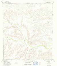
1969 Map of Big Canyon Ranch NW
USGS Topo · Published 1992About this map
The high desert terrain of Pecos County is defined here by the Big Divide, a prominent ridge separating the complex drainage systems of the Trans-Pecos. This 1969 field-checked survey highlights the isolation of West Texas ranching life, centered on the Thorn Ranch in the north and the Mitchell Ranch further south. The landscape is carved by deep seasonal watercourses, most notably the winding path of Big Canyon and its tributary, the Middle Fork Big Canyon.
Find a feature on this map
9 named features on this map. Tap any name to fly to it.
Don’t see what you’re looking for? This feature index may not catch every label — zoom into the map to look around manually.
Map Details
Editions of this 1969 Big Canyon Ranch NW Map
2 editions found
Other maps of this area

1920 · Longfellow
USGS Topo · 1:125,000

1928 · Sanderson
USGS Topo · 1:125,000

1928 · Comanche Spring
USGS Topo · 1:125,000

1929 · Independence Draw Quadrangle
USGS Topo · 1:125,000

1954 · Fort Stockton
USGS Topo · 1:250,000

1958 · Fort Stockton
USGS Topo · 1:250,000

1968 · Busher Canyon
USGS Topo · 1:24,000

1968 · Toms Canyon
USGS Topo · 1:24,000

1969 · Big Canyon Ranch
USGS Topo · 1:24,000

1969 · Big Canyon Ranch NW
USGS Topo · 1:24,000