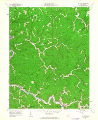
1962 Map of Big Creek
USGS Topo · Published 1963About this map
The Guyandotte river corridor defines the southwestern portion of this 1962 survey, where the Chesapeake and Ohio River railroad tracks parallel the water, connecting the settlements of Ferrellsburg and Toney. This region of the West Virginia coalfields shows a landscape deeply etched by numerous hollows and branches, with many family-named cemeteries such as Justice Cem, Lambert Cem, and Spears Cem tucked into the hillsides.
Find a feature on this map
138 named features on this map. Tap any name to fly to it.
Don’t see what you’re looking for? This feature index may not catch every label — zoom into the map to look around manually.
Map Details
Editions of this 1962 Big Creek Map
2 editions found
Other maps of this area

1887 · Warfield
USGS Topo · 1:125,000

1891 · Oceana
USGS Topo · 1:125,000

1891 · Warfield
USGS Topo · 1:125,000

1892 · Huntington
USGS Topo · 1:125,000

1893 · Oceana
USGS Topo · 1:125,000

1898 · Huntington
USGS Topo · 1:125,000

1898 · Oceana
USGS Topo · 1:125,000

1899 · Charleston
USGS Topo · 1:125,000

1902 · Midkiff
USGS Topo · 1:62,500

1907 · Midkiff
USGS Topo · 1:62,500