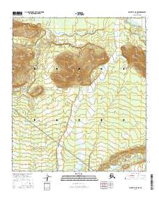
2016 Map of Big Delta A-5 NW
USGS Topo · Published 2016About this map
The Tanana River sweeps across the northern edge of this Interior Alaska landscape, marking a dynamic boundary of braided water and silt. This 2016 survey captures the intricate drainage patterns of the Delta Creek system as it moves north from the higher elevations of the foothills toward the Tanana. The terrain is defined by wide alluvial plains and the persistent movement of water, illustrating the hydrological complexity typical of the region south of the river. While the area lacks developed settlements, the detailed mapping of Clear Creek and the surrounding wetland environments provides critical data for understanding the natural corridors and seasonal shifts of the Alaskan wilderness. The map serves as a primary record of this remote drainage basin, where the confluence of these major glacial-fed streams shapes the physical character of the land.
Find a feature on this map
8 named features on this map. Tap any name to fly to it.
Don’t see what you’re looking for? This feature index may not catch every label — zoom into the map to look around manually.
Map Details
Editions of this 2016 Big Delta A-5 NW Map
This is the sole edition of this map. No revisions or reprints were ever made.
Other maps of this area

1949 · Big Delta B-5
USGS Topo · 1:63,360

1949 · Big Delta B-6
USGS Topo · 1:63,360

1949 · Big Delta A-6
USGS Topo · 1:63,360

1950 · Big Delta
USGS Topo · 1:250,000

1950 · Big Delta A-5
USGS Topo · 1:63,360

1951 · Big Delta
USGS Topo · 1:250,000
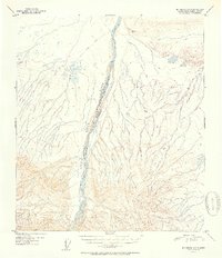
1951 · Big Delta A-6
USGS Topo · 1:63,360

1952 · Big Delta A-5
USGS Topo · 1:63,360

1952 · Big Delta B-6
USGS Topo · 1:63,360

1952 · Big Delta B-5
USGS Topo · 1:63,360