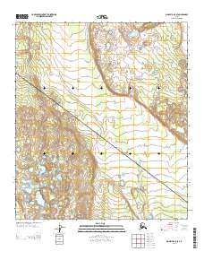
2013 Map of Big Delta A-5 SE
USGS Topo · Published 2013About this map
This remote Alaskan wilderness in the Southeast Fairbanks region is characterized by significant elevation changes and glacial-carved terrain as documented in 2013. The landscape is defined by the intersection of the T 9 S T 10 S township lines and the R 8 E R 9 E range boundaries, which serve as the primary markers for this uninhabited survey. The topography features a complex network of small glacial lakes and drainage patterns that reflect the transition between the high peaks of the Alaska Range and the lower basins. This map provides a technical view of the physical geography of the Interior without the presence of roads or established settlements, focusing instead on the precise contours and hydrography of the natural environment.
Find a feature on this map
2 named features on this map. Tap any name to fly to it.
Don’t see what you’re looking for? This feature index may not catch every label — zoom into the map to look around manually.
Map Details
Editions of this 2013 Big Delta A-5 SE Map
This is the sole edition of this map. No revisions or reprints were ever made.
Other maps of this area

1950 · Mount Hayes
USGS Topo · 1:250,000

1950 · Big Delta
USGS Topo · 1:250,000

1950 · Big Delta A-5
USGS Topo · 1:63,360

1950 · Mount Hayes D-4
USGS Topo · 1:63,360

1950 · Big Delta A-4
USGS Topo · 1:63,360

1950 · Mount Hayes D-5
USGS Topo · 1:63,360

1951 · Big Delta
USGS Topo · 1:250,000

1951 · Mount Hayes
USGS Topo · 1:250,000

1952 · Mount Hayes D-5
USGS Topo · 1:63,360

1952 · Big Delta A-5
USGS Topo · 1:63,360