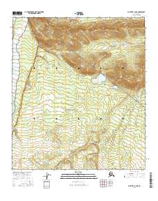
2016 Map of Big Delta A-6 NE
USGS Topo · Published 2016About this map
The Little Delta River flows along the western edge of this subarctic landscape, carving a wide bed against rising elevations to the east. This 2016 survey highlights the transition from the braided river valley to the high, ridged terrain of the Southeast Fairbanks region. The map is defined primarily by its public land survey divisions, spanning portions of T8s R5e, T8s R6e, T9s R5e, and T9s R6e. These boundaries trace the systematic organization of the Alaskan wilderness, showing a landscape largely defined by natural topography and water flow rather than dense human settlement or infrastructure. The detailed contouring illustrates the complex drainage patterns feeding into the main river channel.
Find a feature on this map
5 named features on this map. Tap any name to fly to it.
Don’t see what you’re looking for? This feature index may not catch every label — zoom into the map to look around manually.
Map Details
Editions of this 2016 Big Delta A-6 NE Map
This is the sole edition of this map. No revisions or reprints were ever made.
Other maps of this area

1949 · Big Delta B-5
USGS Topo · 1:63,360

1949 · Big Delta B-6
USGS Topo · 1:63,360

1949 · Big Delta A-6
USGS Topo · 1:63,360

1950 · Big Delta
USGS Topo · 1:250,000

1950 · Big Delta A-5
USGS Topo · 1:63,360

1951 · Big Delta
USGS Topo · 1:250,000
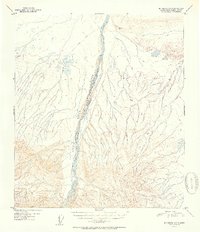
1951 · Big Delta A-6
USGS Topo · 1:63,360

1952 · Big Delta A-5
USGS Topo · 1:63,360

1952 · Big Delta B-6
USGS Topo · 1:63,360

1952 · Big Delta B-5
USGS Topo · 1:63,360