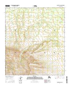
2016 Map of Big Delta A-6 SE
USGS Topo · Published 2016About this map
This part of Southeast Fairbanks, Alaska, is documented through the precise grid of the Public Land Survey System, specifically detailing portions of T9s R5e, T9s R6e, T10s R5e, and T10s R6e. The landscape is primarily defined by significant elevation changes, with contours illustrating the transition from lower drainage areas to prominent high-altitude terrain. Unlike many urbanized quads, this sheet emphasizes the raw topographical structure of the interior, showing the natural drainage patterns and the systematic division of public lands into townships and ranges. This 2016 survey provides a modern topographical baseline for an area defined by its lack of established settlements or named infrastructure.
Find a feature on this map
4 named features on this map. Tap any name to fly to it.
Don’t see what you’re looking for? This feature index may not catch every label — zoom into the map to look around manually.
Map Details
Editions of this 2016 Big Delta A-6 SE Map
This is the sole edition of this map. No revisions or reprints were ever made.
Other maps of this area

1949 · Big Delta A-6
USGS Topo · 1:63,360

1950 · Mount Hayes
USGS Topo · 1:250,000

1950 · Big Delta
USGS Topo · 1:250,000

1950 · Big Delta A-5
USGS Topo · 1:63,360

1950 · Mount Hayes D-6
USGS Topo · 1:63,360

1950 · Mount Hayes D-5
USGS Topo · 1:63,360

1951 · Big Delta
USGS Topo · 1:250,000

1951 · Mount Hayes
USGS Topo · 1:250,000
1951 · Big Delta A-6
USGS Topo · 1:63,360

1952 · Mount Hayes D-5
USGS Topo · 1:63,360