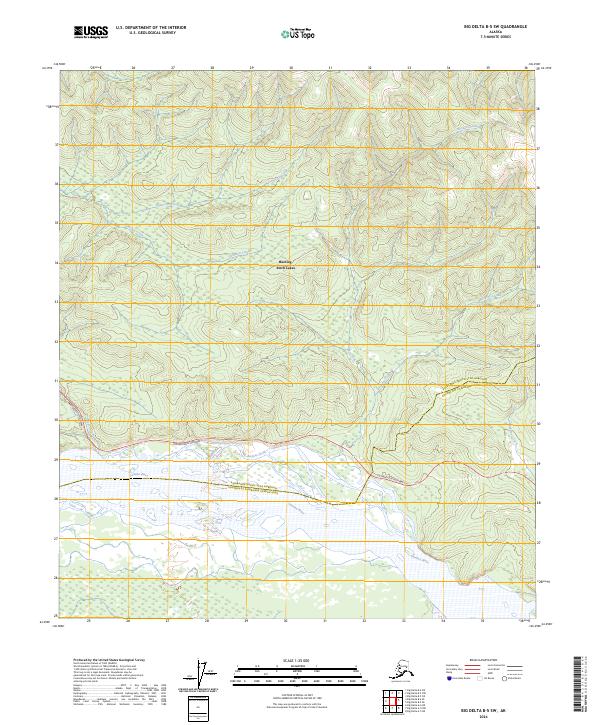
2024 Map of Big Delta B-5 SW
USGS Topo · Published 2024About this map
The Tanana River corridor serves as the primary geographical focus for this section of the Interior, where modern infrastructure meets the complex hydrology of the Alaska wilderness. The Richardson Highway cuts across the landscape, paralleling the river and providing critical access to the Harding- Birch Lakes recreational area. This modern survey illustrates the proximity of these major lakes to the surrounding watershed, defined by a network of drainage systems including Banner Creek, Democrat Creek, and Junction Creek. The terrain is marked by significant topographical variation, notably at the Canyon near the river’s edge. By tracing the paths of Buckeye Creek and Tenderfoot Creek, researchers can observe the interface between protected state lands and the borough boundaries that divide this transition zone between Fairbanks and Delta Junction.
Find a feature on this map
18 named features on this map. Tap any name to fly to it.
Don’t see what you’re looking for? This feature index may not catch every label — zoom into the map to look around manually.
Map Details
Editions of this 2024 Big Delta B-5 SW Map
This is the sole edition of this map. No revisions or reprints were ever made.
Other maps of this area

1949 · Big Delta B-5
USGS Topo · 1:63,360

1949 · Big Delta B-6
USGS Topo · 1:63,360

1949 · Big Delta A-6
USGS Topo · 1:63,360

1950 · Big Delta
USGS Topo · 1:250,000

1950 · Big Delta A-5
USGS Topo · 1:63,360

1951 · Big Delta
USGS Topo · 1:250,000
1951 · Big Delta A-6
USGS Topo · 1:63,360

1952 · Big Delta A-5
USGS Topo · 1:63,360

1952 · Big Delta B-6
USGS Topo · 1:63,360

1952 · Big Delta B-5
USGS Topo · 1:63,360