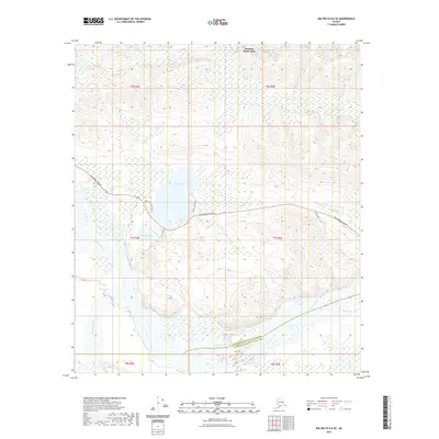
2021 Map of Big Delta B-6 SE
USGS Topo · Published 2021About this map
Tanana River and Little Delta River dominate the southern half of this interior Alaskan landscape, where the braided river channels transition into the wetlands surrounding Birch Lake. This 2021 survey by the U.S. Geological Survey illustrates the modern infrastructure serving the Harding-Birch Lakes area, primarily concentrated along the Richardson Highway. Local access is defined by specialized routes such as Hermitage Acres Road, Lost Lake Road, and Tower Road, which connect the lakefront to the primary highway corridor.
Find a feature on this map
20 named features on this map. Tap any name to fly to it.
Don’t see what you’re looking for? This feature index may not catch every label — zoom into the map to look around manually.
Map Details
Editions of this 2021 Big Delta B-6 SE Map
This is the sole edition of this map. No revisions or reprints were ever made.
Other maps of this area

1949 · Big Delta B-5
USGS Topo · 1:63,360

1949 · Big Delta B-6
USGS Topo · 1:63,360

1949 · Big Delta A-6
USGS Topo · 1:63,360

1950 · Big Delta
USGS Topo · 1:250,000

1950 · Big Delta A-5
USGS Topo · 1:63,360

1951 · Big Delta
USGS Topo · 1:250,000
1951 · Big Delta A-6
USGS Topo · 1:63,360

1952 · Big Delta A-5
USGS Topo · 1:63,360

1952 · Big Delta B-6
USGS Topo · 1:63,360

1952 · Big Delta B-5
USGS Topo · 1:63,360