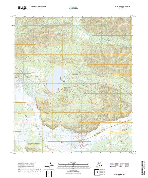
2024 Map of Big Delta B-6 SE
USGS Topo · Published 2024About this map
The Tanana River and the Little Delta River dominate the southern half of this interior Alaskan landscape, where the braided river channels and surrounding wetlands meet the rising terrain of the north. Central to the map is the settlement of Harding-Birch Lakes, a pocket of habitation centered around the water bodies of Birch Lake and Chisholm Lake. The presence of the Birch Lake Recreation Annex and several localized road networks, such as Boardwalk Drive and Hermitage Acres Road, indicates the area's role as a recreational and residential hub along the transport corridor.
Find a feature on this map
22 named features on this map. Tap any name to fly to it.
Don’t see what you’re looking for? This feature index may not catch every label — zoom into the map to look around manually.
Map Details
Editions of this 2024 Big Delta B-6 SE Map
This is the sole edition of this map. No revisions or reprints were ever made.
Other maps of this area

1949 · Big Delta B-5
USGS Topo · 1:63,360

1949 · Big Delta B-6
USGS Topo · 1:63,360

1949 · Big Delta A-6
USGS Topo · 1:63,360

1950 · Big Delta
USGS Topo · 1:250,000

1950 · Big Delta A-5
USGS Topo · 1:63,360

1951 · Big Delta
USGS Topo · 1:250,000
1951 · Big Delta A-6
USGS Topo · 1:63,360

1952 · Big Delta A-5
USGS Topo · 1:63,360

1952 · Big Delta B-6
USGS Topo · 1:63,360

1952 · Big Delta B-5
USGS Topo · 1:63,360