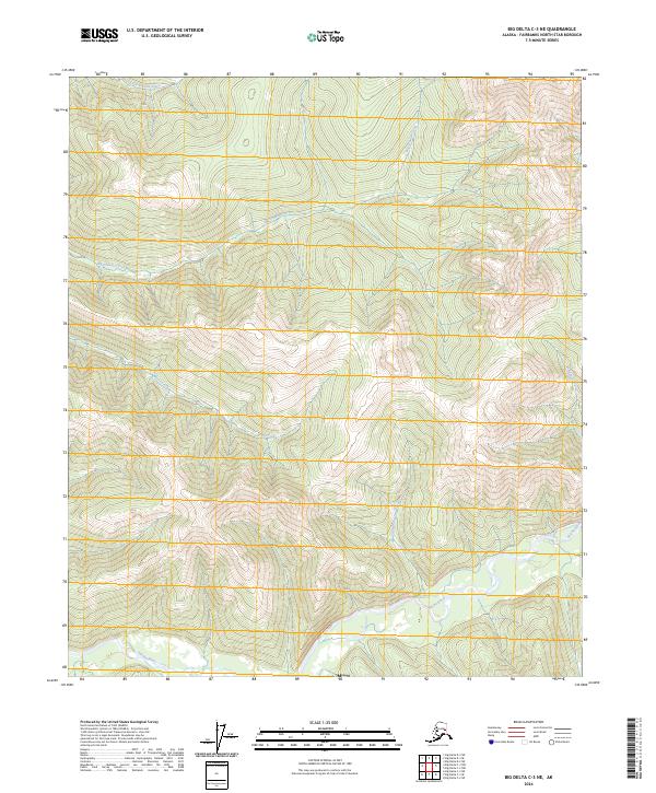
2024 Map of Big Delta C-3 NE
USGS Topo · Published 2024About this map
The Salcha River dominates the southern reaches of this interior Alaska terrain, carving a broad valley through the mountainous landscape of the Fairbanks North Star Borough. This 2024 survey captures a wilderness drainage system characterized by steep ridges and multiple narrow creek valleys that feed into the primary river corridor. To the north, Big Granite Creek and Little Granite Creek define the upper elevations, while the curiously named Stone Boys Tent Creek flows southward to join the Salcha. The map illustrates a landscape primarily shaped by its hydrology, with Bear Creek and Maiden Creek marking the western and eastern edges of the central mountain mass. This document serves as a modern record of natural landforms and township boundaries including t2s r13e and t3s r13e, where the absence of developed infrastructure highlights the region's untamed character.
Find a feature on this map
12 named features on this map. Tap any name to fly to it.
Don’t see what you’re looking for? This feature index may not catch every label — zoom into the map to look around manually.
Map Details
Editions of this 2024 Big Delta C-3 NE Map
This is the sole edition of this map. No revisions or reprints were ever made.
Other maps of this area

1950 · Big Delta
USGS Topo · 1:250,000

1951 · Big Delta
USGS Topo · 1:250,000

1958 · Big Delta C-3
USGS Topo · 1:63,360

1958 · Big Delta D-3
USGS Topo · 1:63,360

1958 · Big Delta D-2
USGS Topo · 1:63,360

1958 · Big Delta C-2
USGS Topo · 1:63,360

1958 · Big Delta
USGS Topo · 1:250,000
1973 · Big Delta D-3
USGS Topo · 1:63,360
2016 · Big Delta C-3 SE
USGS Topo · 1:25,000
2016 · Big Delta D-3 SW
USGS Topo · 1:25,000