
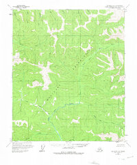
1958 Map of Big Delta D-3
USGS Topo · Published 1965About this map
The North Fork Salcha River dominates this interior Alaska landscape, carving a complex drainage network through the high country of the Big Delta region. During the late 1950s, this area remained largely wilderness, with a lone Cabin situated along the river's path as the only significant sign of habitation. The terrain is defined by a series of named tributaries that hint at the region's prospecting and natural history, including the aptly named Gold Creek and Bonanza Creek in the south, alongside Black Bear Creek and Salmontrout Creek. Surveyed by the Bureau of Land Management, the map shows the established Base Line and township grids which, at the time of publication, represented unsurveyed and unmarked locations predetermined for future land management. This survey provides a record of the watershed's original nomenclature before significant modern development reached these remote northern forks.
Find a feature on this map
20 named features on this map. Tap any name to fly to it.
Don’t see what you’re looking for? This feature index may not catch every label — zoom into the map to look around manually.
Map Details
Editions of this 1958 Big Delta D-3 Map
2 editions found
Other maps of this area

1950 · Big Delta
USGS Topo · 1:250,000

1951 · Big Delta
USGS Topo · 1:250,000

1951 · Circle
USGS Topo · 1:250,000

1952 · Circle A-4
USGS Topo · 1:63,360

1955 · Circle A-2
USGS Topo · 1:63,360

1955 · Circle A-3
USGS Topo · 1:63,360

1955 · Circle
USGS Topo · 1:250,000

1958 · Big Delta C-4
USGS Topo · 1:63,360

1958 · Big Delta D-4
USGS Topo · 1:63,360

1958 · Big Delta C-3
USGS Topo · 1:63,360