
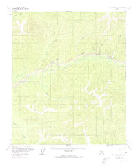
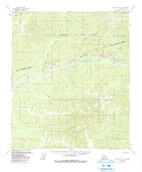
1958 Map of Big Delta C-4
USGS Topo · Published 1963About this map
The Salcha River dominates the central interior landscape of this 1950s survey, winding through a complex network of drainages and high ridges east of Fairbanks. This era of mapping captured the territory as it was being actively used for mining and exploration, evidenced by the presence of the Tractor Trail following the riverbanks and a remote Landing Strip for bush pilots. Small outposts like Caribou and various scattered Cabins mark the limited human footprint in this wilderness.
Find a feature on this map
14 named features on this map. Tap any name to fly to it.
Don’t see what you’re looking for? This feature index may not catch every label — zoom into the map to look around manually.
Map Details
Editions of this 1958 Big Delta C-4 Map
3 editions found
Other maps of this area

1949 · Big Delta B-5
USGS Topo · 1:63,360

1950 · Big Delta
USGS Topo · 1:250,000

1950 · Big Delta B-4
USGS Topo · 1:63,360

1951 · Big Delta
USGS Topo · 1:250,000

1952 · Big Delta B-5
USGS Topo · 1:63,360

1953 · Big Delta B-4
USGS Topo · 1:63,360

1958 · Big Delta C-5
USGS Topo · 1:63,360

1958 · Big Delta D-5
USGS Topo · 1:63,360

1958 · Big Delta D-4
USGS Topo · 1:63,360

1958 · Big Delta B-3
USGS Topo · 1:63,360