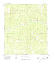
1958 Map of Big Delta C-4
USGS Topo · Published 1974About this map
The Salcha River dominates this interior Alaska landscape, weaving a complex drainage pattern through the Big Delta region. Photogrammetric methods from the early 1950s, updated with 1970s aerial observations, reveal a wilderness shaped by river systems and remote outposts like Caribou. Human presence is marked by isolated Cabins and a network of Tractor Trails that cross the high ground between watersheds. The map provides a detailed view of the terrain before modern infrastructure, where travel relied on these rugged trails and small clearings such as the Landing Strip along Butte Creek. In the north, the headwaters of the S Fk Chena River and Caribou Creek illustrate the radial drainage typical of this subarctic environment. The topography is defined by the steep valleys of No Grub Creek, Deep Creek, and Pasco Creek, offering a glimpse into the logistical challenges of surveying and navigating the Alaskan interior during the mid-century.
Find a feature on this map
14 named features on this map. Tap any name to fly to it.
Don’t see what you’re looking for? This feature index may not catch every label — zoom into the map to look around manually.
Map Details
Editions of this 1958 Big Delta C-4 Map
3 editions found
Other maps of this area

1949 · Big Delta B-5
USGS Topo · 1:63,360

1950 · Big Delta
USGS Topo · 1:250,000

1950 · Big Delta B-4
USGS Topo · 1:63,360

1951 · Big Delta
USGS Topo · 1:250,000

1952 · Big Delta B-5
USGS Topo · 1:63,360

1953 · Big Delta B-4
USGS Topo · 1:63,360

1958 · Big Delta C-5
USGS Topo · 1:63,360

1958 · Big Delta D-5
USGS Topo · 1:63,360

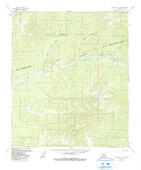
1958 · Big Delta C-4
USGS Topo · 1:63,360

1958 · Big Delta D-4
USGS Topo · 1:63,360