
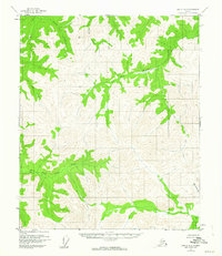
1955 Map of Circle A-2
USGS Topo · Published 1959About this map
The East Fork Chena River and the Salcha River drainage systems define this interior Alaskan landscape, surveyed during the mid-1950s. This unpopulated expanse is characterized by high ridges and a series of branching waterways, including the descriptively named Big Windy Creek and Little Windy Gl. The survey provides a high-elevation point of reference at VABM 4476 Tip, while the lower elevations are marked by the convergence of Grizzly Creek, Wolf Creek, and Sheep Creek. The lack of roads or established trails at the time of this 1955 survey highlights the remote character of the Yukon-Koyukuk region, where travel was dictated almost entirely by the natural corridors of the river forks and mountain passes.
Find a feature on this map
8 named features on this map. Tap any name to fly to it.
Don’t see what you’re looking for? This feature index may not catch every label — zoom into the map to look around manually.
Map Details
Editions of this 1955 Circle A-2 Map
2 editions found
Other maps of this area

1950 · Big Delta
USGS Topo · 1:250,000

1951 · Big Delta
USGS Topo · 1:250,000

1951 · Circle
USGS Topo · 1:250,000

1955 · Circle B-3
USGS Topo · 1:63,360

1955 · Circle A-1
USGS Topo · 1:63,360

1955 · Circle B-1
USGS Topo · 1:63,360

1955 · Circle A-3
USGS Topo · 1:63,360

1955 · Circle B-2
USGS Topo · 1:63,360

1955 · Circle
USGS Topo · 1:250,000

1958 · Big Delta D-3
USGS Topo · 1:63,360