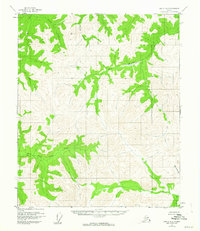
1955 Map of Circle A-2
USGS Topo · Published 1963About this map
East Fork Chena River and the Salcha River drainage systems define the high-elevation interior landscape shown in this mid-1950s survey. The map reveals a roadless wilderness dominated by complex ridgelines and branching creek networks, including Big Windy Creek and Little Windy Creek. A geodetic marker at VABM 4476 Tip provides a specific reference point for surveyors and navigators in a region otherwise characterized by its natural watercourses. The lack of established roads or trails during this period reflects the isolation of the Yukon-Koyukuk region before more modern infrastructure reached these upland basins. Tributaries such as Grizzly Creek, Wolf Creek, and Sheep Creek are clearly delineated, tracing the natural flow of the interior's watershed.
Find a feature on this map
8 named features on this map. Tap any name to fly to it.
Don’t see what you’re looking for? This feature index may not catch every label — zoom into the map to look around manually.
Map Details
Editions of this 1955 Circle A-2 Map
2 editions found
Other maps of this area

1950 · Big Delta
USGS Topo · 1:250,000

1951 · Big Delta
USGS Topo · 1:250,000

1951 · Circle
USGS Topo · 1:250,000

1955 · Circle B-3
USGS Topo · 1:63,360

1955 · Circle A-2
USGS Topo · 1:63,360

1955 · Circle A-1
USGS Topo · 1:63,360

1955 · Circle B-1
USGS Topo · 1:63,360

1955 · Circle A-3
USGS Topo · 1:63,360

1955 · Circle B-2
USGS Topo · 1:63,360

1955 · Circle
USGS Topo · 1:250,000