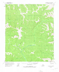
1958 Map of Big Delta D-3
USGS Topo · Published 1975About this map
The Military Reservation occupies a massive corridor of this interior Alaskan landscape, surveyed during the early 1950s. The terrain is defined by a dense network of drainages feeding into the Salcha River and its prominent North Fork Salcha River. The presence of a lone Cabin near the river fork suggests the sparse human footprint in this wilderness area at the time of the survey.
Find a feature on this map
18 named features on this map. Tap any name to fly to it.
Don’t see what you’re looking for? This feature index may not catch every label — zoom into the map to look around manually.
Map Details
Editions of this 1958 Big Delta D-3 Map
2 editions found

Other maps of this area

1950 · Big Delta
USGS Topo · 1:250,000

1951 · Big Delta
USGS Topo · 1:250,000

1951 · Circle
USGS Topo · 1:250,000

1952 · Circle A-4
USGS Topo · 1:63,360

1955 · Circle A-2
USGS Topo · 1:63,360

1955 · Circle A-3
USGS Topo · 1:63,360

1955 · Circle
USGS Topo · 1:250,000

1958 · Big Delta C-4
USGS Topo · 1:63,360

1958 · Big Delta D-4
USGS Topo · 1:63,360

1958 · Big Delta C-3
USGS Topo · 1:63,360