
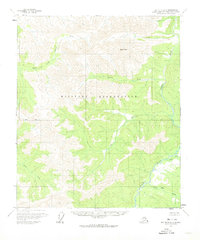
1958 Map of Big Delta D-2
USGS Topo · Published 1965About this map
The Military Reservation dominates the central and southern portions of this Alaskan interior landscape, illustrating the strategic importance of the territory during the mid-20th century. High elevations are punctuated by West Point, while the hydrological network is defined by the Salcha River and its major tributary, the North Fork Salcha River. The map captures a moment when human presence was extremely sparse, marked only by isolated structures such as Cabin (Ruins) and a single Cabin along the watercourses. A complex drainage system including Boulder Creek, Dan Creek, and Ricks Creek carves through the terrain, providing a look at the unsurveyed and unmarked land lines predetermined by the Bureau of Land Management before extensive ground checking was completed.
Find a feature on this map
13 named features on this map. Tap any name to fly to it.
Don’t see what you’re looking for? This feature index may not catch every label — zoom into the map to look around manually.
Map Details
Editions of this 1958 Big Delta D-2 Map
2 editions found
Other maps of this area

1950 · Big Delta
USGS Topo · 1:250,000

1951 · Big Delta
USGS Topo · 1:250,000

1951 · Circle
USGS Topo · 1:250,000

1955 · Circle A-2
USGS Topo · 1:63,360

1955 · Circle A-1
USGS Topo · 1:63,360

1955 · Circle A-3
USGS Topo · 1:63,360

1955 · Circle
USGS Topo · 1:250,000

1958 · Big Delta C-3
USGS Topo · 1:63,360

1958 · Big Delta D-3
USGS Topo · 1:63,360

1958 · Big Delta D-1
USGS Topo · 1:63,360