
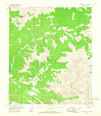
1958 Map of Big Delta D-1
USGS Topo · Published 1965About this map
The Salcha River dominates the western edge of this 1950s interior Alaskan landscape, where the drainage systems of Lost Creek and Serpentine Creek carve through the high elevations. Much of the central and western terrain is occupied by a large Military Reservation, marking a significant land use designation in the post-war era. The survey provides a clear view of the complex hydrology of the region, including the headwaters of Cottonwood Creek and Paldo Creek, alongside the smaller Stone Boy Creek. The eastern portion of the quadrangle is defined by its relief, crossing the North Star Borough Bdy. This map records the wilderness before significant infrastructure or permanent settlements reached these upper tributaries, showing only the natural features and the official Base Line surveyed through the territory.
Find a feature on this map
10 named features on this map. Tap any name to fly to it.
Don’t see what you’re looking for? This feature index may not catch every label — zoom into the map to look around manually.
Map Details
Editions of this 1958 Big Delta D-1 Map
2 editions found
Other maps of this area

1950 · Big Delta
USGS Topo · 1:250,000

1951 · Big Delta
USGS Topo · 1:250,000

1951 · Charley River
USGS Topo · 1:250,000

1951 · Eagle
USGS Topo · 1:250,000

1951 · Circle
USGS Topo · 1:250,000

1955 · Circle A-2
USGS Topo · 1:63,360

1955 · Circle A-1
USGS Topo · 1:63,360

1955 · Circle
USGS Topo · 1:250,000

1956 · Charley River A-6
USGS Topo · 1:63,360

1956 · Charley River
USGS Topo · 1:250,000