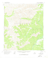
1958 Map of Big Delta D-2
USGS Topo · Published 1974About this map
The Military Reservation occupies a central swath of this interior landscape, marking a period of strategic land use in the Fairbanks North Star Borough. The terrain is defined by the winding course of the Salcha River and its numerous tributaries, including Stone Boy Creek and Paldo Creek. The 1:63,360 scale detail reveals the remote nature of the region in the late 1950s, where human presence is noted only by a few structures such as a Cabin (Ruins) and another isolated Cabin near Ricks Creek.
Find a feature on this map
13 named features on this map. Tap any name to fly to it.
Don’t see what you’re looking for? This feature index may not catch every label — zoom into the map to look around manually.
Map Details
Editions of this 1958 Big Delta D-2 Map
2 editions found
Other maps of this area

1950 · Big Delta
USGS Topo · 1:250,000

1951 · Big Delta
USGS Topo · 1:250,000

1951 · Circle
USGS Topo · 1:250,000

1955 · Circle A-2
USGS Topo · 1:63,360

1955 · Circle A-1
USGS Topo · 1:63,360

1955 · Circle A-3
USGS Topo · 1:63,360

1955 · Circle
USGS Topo · 1:250,000

1958 · Big Delta C-3
USGS Topo · 1:63,360

1958 · Big Delta D-3
USGS Topo · 1:63,360

1958 · Big Delta D-2
USGS Topo · 1:63,360