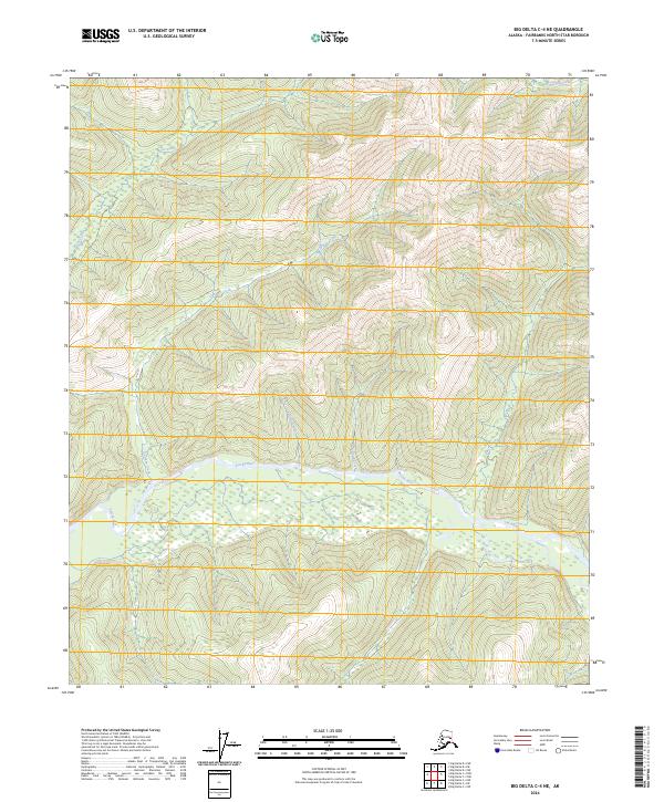
2024 Map of Big Delta C-4 NE
USGS Topo · Published 2024About this map
The Salcha River dominates the central landscape of this interior Alaskan quadrangle, winding through the Fairbanks North Star Borough. The map detail shows the river's complex drainage system, fed by several northern tributaries including Butte Creek, Caribou Creek, and the uniquely named Bullfrog Creek. To the east, No Grub Creek and Pasca Creek join the main river channel as it flows through the township boundaries of t3s r10e and t3s r11e. In the northern highlands, Bonanza Creek flows through higher elevations, illustrating the remote and hydrological character of this region. The absence of roads or permanent structures on this sheet underscores the wilderness nature of the territory north of the Tanana River valley.
Find a feature on this map
11 named features on this map. Tap any name to fly to it.
Don’t see what you’re looking for? This feature index may not catch every label — zoom into the map to look around manually.
Map Details
Editions of this 2024 Big Delta C-4 NE Map
This is the sole edition of this map. No revisions or reprints were ever made.
Other maps of this area

1950 · Big Delta
USGS Topo · 1:250,000

1951 · Big Delta
USGS Topo · 1:250,000

1958 · Big Delta C-4
USGS Topo · 1:63,360

1958 · Big Delta D-4
USGS Topo · 1:63,360

1958 · Big Delta C-3
USGS Topo · 1:63,360

1958 · Big Delta D-3
USGS Topo · 1:63,360

1958 · Big Delta
USGS Topo · 1:250,000
1973 · Big Delta D-3
USGS Topo · 1:63,360
2016 · Big Delta D-4 SE
USGS Topo · 1:25,000
2016 · Big Delta D-3 SW
USGS Topo · 1:25,000