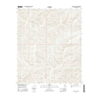
2016 Map of Big Delta C-6 NE
USGS Topo · Published 2016About this map
Globe Creek and its tributaries define this interior Alaskan landscape within the Fairbanks North Star Borough, where the terrain is marked by steep elevation changes and dense drainage patterns. The hydrology of the region is centered on several major watercourses, including the westward flow of Hunts Creek in the north and Moose Creek to the south. This 2016 survey illustrates the undeveloped character of the Alaskan wilderness north of Big Delta, where the land is partitioned by the Public Land Survey System into sections within t2s r5e, t2s r6e, t3s r5e, and t3s r6e. The lack of road infrastructure or named settlements emphasizes the isolation of these headwaters, which feed eventually into the larger Tanana River system. Researchers will find a precise record of the natural topography, from the high ridgelines to the marshy lowlands surrounding French Creek.
Find a feature on this map
8 named features on this map. Tap any name to fly to it.
Don’t see what you’re looking for? This feature index may not catch every label — zoom into the map to look around manually.
Map Details
Editions of this 2016 Big Delta C-6 NE Map
This is the sole edition of this map. No revisions or reprints were ever made.
Other maps of this area

1949 · Big Delta C-6
USGS Topo · 1:63,360

1950 · Big Delta
USGS Topo · 1:250,000

1950 · Big Delta D-6
USGS Topo · 1:63,360

1951 · Big Delta
USGS Topo · 1:250,000

1952 · Big Delta C-6
USGS Topo · 1:63,360

1952 · Big Delta D-6
USGS Topo · 1:63,360

1958 · Big Delta C-5
USGS Topo · 1:63,360

1958 · Big Delta D-5
USGS Topo · 1:63,360

1958 · Big Delta
USGS Topo · 1:250,000
1992 · Big Delta D-6 SW
USGS Topo · 1:25,000