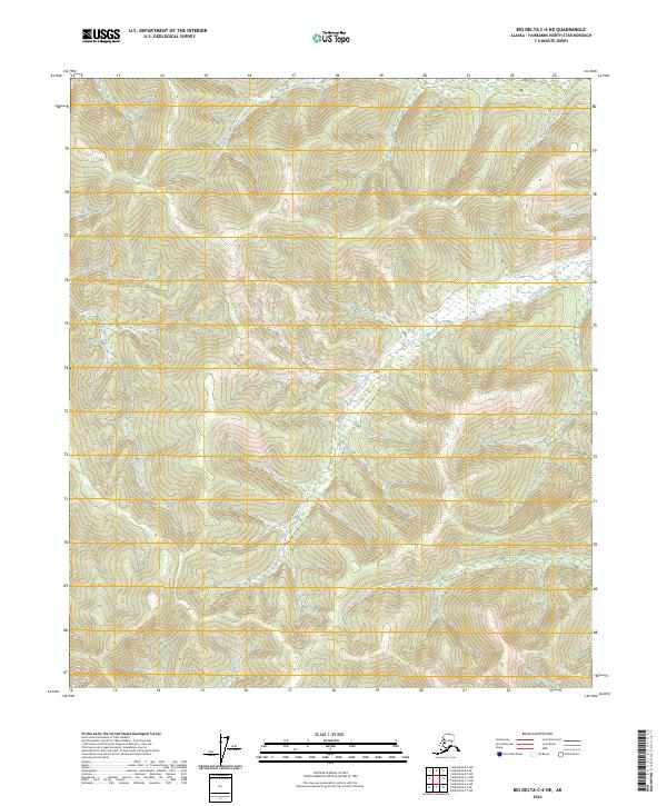
2024 Map of Big Delta C-6 NE
USGS Topo · Published 2024About this map
Little Salcha River and its northern tributaries dominate this interior Alaskan landscape, which remains largely untouched by modern road infrastructure. The drainage patterns of Stuart Creek and French Creek reveal a complex network of high-elevation ridges and valleys characteristic of the Yukon-Tanana Upland. These watercourses serve as the primary landmarks in an area defined by its topographic relief rather than human settlement. The absence of built labels suggests a region primarily used for subsistence, seasonal transit, or resource management, with the Globe Creek and Hunts Creek watersheds providing a clear look at the headwater geography of the Fairbanks North Star Borough.
Find a feature on this map
10 named features on this map. Tap any name to fly to it.
Don’t see what you’re looking for? This feature index may not catch every label — zoom into the map to look around manually.
Map Details
Editions of this 2024 Big Delta C-6 NE Map
This is the sole edition of this map. No revisions or reprints were ever made.
Other maps of this area

1949 · Big Delta C-6
USGS Topo · 1:63,360

1950 · Big Delta
USGS Topo · 1:250,000

1950 · Big Delta D-6
USGS Topo · 1:63,360

1951 · Big Delta
USGS Topo · 1:250,000

1952 · Big Delta C-6
USGS Topo · 1:63,360

1952 · Big Delta D-6
USGS Topo · 1:63,360

1958 · Big Delta C-5
USGS Topo · 1:63,360

1958 · Big Delta D-5
USGS Topo · 1:63,360

1958 · Big Delta
USGS Topo · 1:250,000
1992 · Big Delta D-6 SW
USGS Topo · 1:25,000