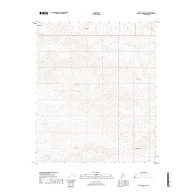
2018 Map of Big Delta D-2 SW
USGS Topo · Published 2018About this map
The interior Alaska wilderness within the Big Delta D-2 SW quadrangle is defined by steep, unnamed ridges and the drainage basins of several small tributaries. Flowing through the central and western portions of this terrain are Ricks Cr and Black Bear Cr, while Platt Cr cuts through the eastern sections. This 2018 survey reveals a landscape largely devoid of human infrastructure, focusing instead on the hydrography and elevation contours that dictate the movement of water through the Fairbanks North Star Borough. The map provides a precise look at the township and range boundaries including t1n r14e and t1s r14e, which serve as the primary organizational framework for this remote section of the Alaskan interior.
Find a feature on this map
10 named features on this map. Tap any name to fly to it.
Don’t see what you’re looking for? This feature index may not catch every label — zoom into the map to look around manually.
Map Details
Editions of this 2018 Big Delta D-2 SW Map
This is the sole edition of this map. No revisions or reprints were ever made.
Other maps of this area

1950 · Big Delta
USGS Topo · 1:250,000

1951 · Big Delta
USGS Topo · 1:250,000

1958 · Big Delta C-3
USGS Topo · 1:63,360

1958 · Big Delta D-3
USGS Topo · 1:63,360

1958 · Big Delta D-2
USGS Topo · 1:63,360

1958 · Big Delta C-2
USGS Topo · 1:63,360

1958 · Big Delta
USGS Topo · 1:250,000
1973 · Big Delta D-3
USGS Topo · 1:63,360
2016 · Big Delta D-3 NE
USGS Topo · 1:25,000
2016 · Big Delta D-3 SE
USGS Topo · 1:25,000