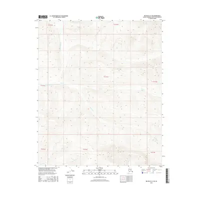
2016 Map of Big Delta D-3 SE
USGS Topo · Published 2016About this map
The North Fork Salcha River winds through the northern reaches of this interior Alaskan landscape within the Fairbanks North Star Borough. The terrain is defined by a dense network of watercourses and elevation changes, where tributaries like Ricks Cr and Black Bear Cr drain the high ground. In the southern portion of the quadrangle, Little Granite Cr and Big Granite Cr carve distinct paths through the wilderness. This survey, compiled from imagery dating between 2009 and 2015, shows a largely undeveloped region where the hydrography dictates the shape of the land. The mapping reveals the complex drainage patterns typical of this subarctic environment, offering a detailed look at the watershed before it reaches more populated areas of the Tanana Valley.
Find a feature on this map
7 named features on this map. Tap any name to fly to it.
Don’t see what you’re looking for? This feature index may not catch every label — zoom into the map to look around manually.
Map Details
Editions of this 2016 Big Delta D-3 SE Map
This is the sole edition of this map. No revisions or reprints were ever made.
Other maps of this area

1950 · Big Delta
USGS Topo · 1:250,000

1951 · Big Delta
USGS Topo · 1:250,000

1958 · Big Delta C-3
USGS Topo · 1:63,360

1958 · Big Delta D-3
USGS Topo · 1:63,360

1958 · Big Delta D-2
USGS Topo · 1:63,360

1958 · Big Delta C-2
USGS Topo · 1:63,360

1958 · Big Delta
USGS Topo · 1:250,000
1973 · Big Delta D-3
USGS Topo · 1:63,360
2016 · Big Delta D-3 NW
USGS Topo · 1:25,000
2016 · Big Delta D-3 SW
USGS Topo · 1:25,000