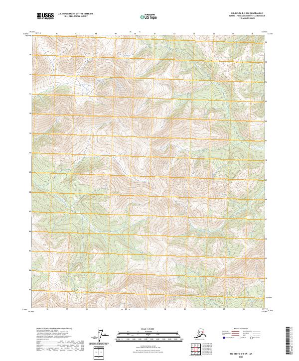
2024 Map of Big Delta D-2 SW
USGS Topo · Published 2024About this map
High-altitude interior terrain dominates this part of the t1s r14e and t1n r14e townships in the Fairbanks North Star Borough. The landscape is defined by the steep, intricately contoured drainages of the Ricks Creek and Dan Creek watersheds. This remote wilderness area, documented in 2024, shows a complex network of ridgelines and valleys characteristic of the northern interior. The drainage patterns of Ricks Creek in the western half of the map and Dan Creek in the southeast provide clear geographic markers for understanding the local hydrography in this undeveloped section of the Big Delta region.
Find a feature on this map
9 named features on this map. Tap any name to fly to it.
Don’t see what you’re looking for? This feature index may not catch every label — zoom into the map to look around manually.
Map Details
Editions of this 2024 Big Delta D-2 SW Map
This is the sole edition of this map. No revisions or reprints were ever made.
Other maps of this area

1950 · Big Delta
USGS Topo · 1:250,000

1951 · Big Delta
USGS Topo · 1:250,000

1958 · Big Delta C-3
USGS Topo · 1:63,360

1958 · Big Delta D-3
USGS Topo · 1:63,360

1958 · Big Delta D-2
USGS Topo · 1:63,360

1958 · Big Delta C-2
USGS Topo · 1:63,360

1958 · Big Delta
USGS Topo · 1:250,000
1973 · Big Delta D-3
USGS Topo · 1:63,360
2016 · Big Delta D-3 NE
USGS Topo · 1:25,000
2016 · Big Delta D-3 SE
USGS Topo · 1:25,000