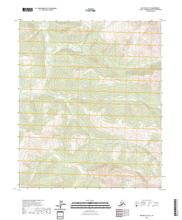
2024 Map of Big Delta D-3 SE
USGS Topo · Published 2024About this map
North Fork Salcha River dominates the northwestern corner of this interior Alaskan landscape, which is defined by a dense network of high-elevation tributaries. Flowing through the Fairbanks North Star Borough, the terrain is shaped by the descent of Ricks Creek and Black Bear Creek from the surrounding uplands. In the southern portion of the quadrangle, the drainage pattern shifts as Little Granite Creek and Big Granite Creek carve through the topography. This survey captures a remote wilderness area where the United States Geological Survey has meticulously tracked water courses across multiple township boundaries, including t1s r13e and t2s r13e. The map serves as a primary record of the hydrological structure of the region prior to any significant modern development.
Find a feature on this map
13 named features on this map. Tap any name to fly to it.
Don’t see what you’re looking for? This feature index may not catch every label — zoom into the map to look around manually.
Map Details
Editions of this 2024 Big Delta D-3 SE Map
This is the sole edition of this map. No revisions or reprints were ever made.
Other maps of this area

1950 · Big Delta
USGS Topo · 1:250,000

1951 · Big Delta
USGS Topo · 1:250,000

1958 · Big Delta C-3
USGS Topo · 1:63,360

1958 · Big Delta D-3
USGS Topo · 1:63,360

1958 · Big Delta D-2
USGS Topo · 1:63,360

1958 · Big Delta C-2
USGS Topo · 1:63,360

1958 · Big Delta
USGS Topo · 1:250,000
1973 · Big Delta D-3
USGS Topo · 1:63,360
2016 · Big Delta D-3 NW
USGS Topo · 1:25,000
2016 · Big Delta D-3 SW
USGS Topo · 1:25,000