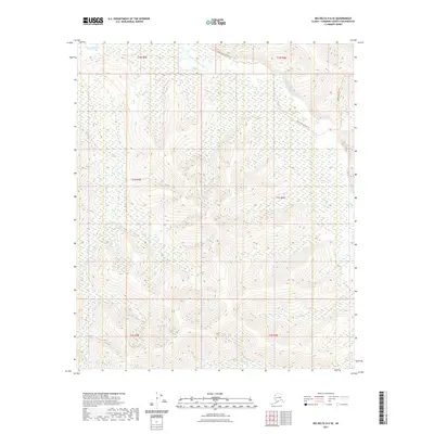
2021 Map of Big Delta D-6 SE
USGS Topo · Published 2021About this map
The South Fork Chena River winds through the northern reaches of this Alaskan interior landscape, meeting the main stem of the Chena River in a complex network of wetlands and shifting channels. This terrain, characterized by significant elevation changes, is historically accessed by seasonal routes like the South Fork Winter Trl, which traverses the high ground between drainage basins. In the southeast, the Mastodon Trl skirts the higher ridges, reflecting the long-standing reliance on trail systems for navigating the remote backcountry of the Fairbanks North Star Borough. Drainage systems like Hunts Cr and Globe Cr define the local topography, carving deep valleys between the prominent ridges that dominate the central and southern portions of the map.
Find a feature on this map
12 named features on this map. Tap any name to fly to it.
Don’t see what you’re looking for? This feature index may not catch every label — zoom into the map to look around manually.
Map Details
Editions of this 2021 Big Delta D-6 SE Map
This is the sole edition of this map. No revisions or reprints were ever made.
Other maps of this area

1949 · Big Delta C-6
USGS Topo · 1:63,360

1950 · Big Delta
USGS Topo · 1:250,000

1950 · Big Delta D-6
USGS Topo · 1:63,360

1951 · Big Delta
USGS Topo · 1:250,000

1952 · Big Delta C-6
USGS Topo · 1:63,360

1952 · Big Delta D-6
USGS Topo · 1:63,360

1958 · Big Delta C-5
USGS Topo · 1:63,360

1958 · Big Delta D-5
USGS Topo · 1:63,360

1958 · Big Delta
USGS Topo · 1:250,000
1992 · Big Delta D-6 SW
USGS Topo · 1:25,000